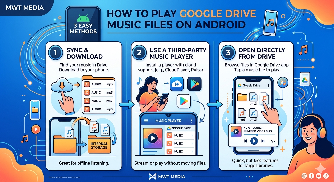
How to Play Google Drive Music on Android 2026
If you want to play Google Drive music on Android, the built-in Drive app will disappoint you fast — no queue, no shuffle, playback stops the moment you lock your screen. It’s a file storage app, not a music player. Here are five methods that actually
Read More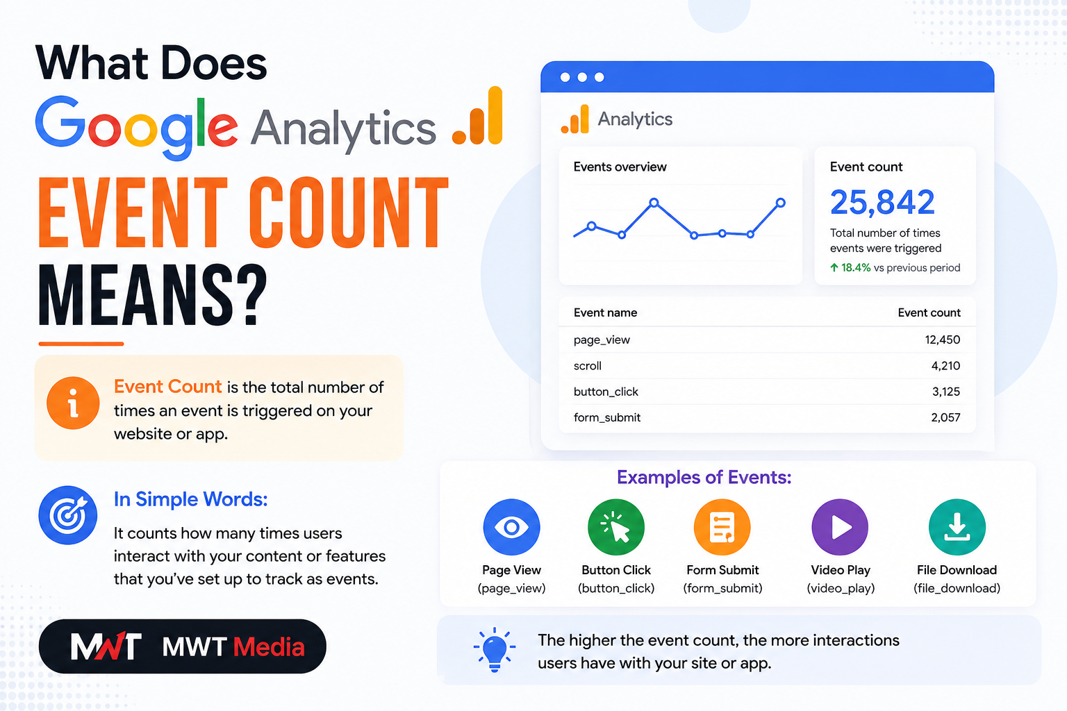
What Does Event Count in Google Analytics Mean? A Complete Guide
If you’ve ever opened your Google Analytics 4 (GA4) dashboard and found yourself staring at a column labeled “Event Count” — wondering what it actually means and why it matters — you’re in the right place. Event count is one of the most powerful and frequently
Read More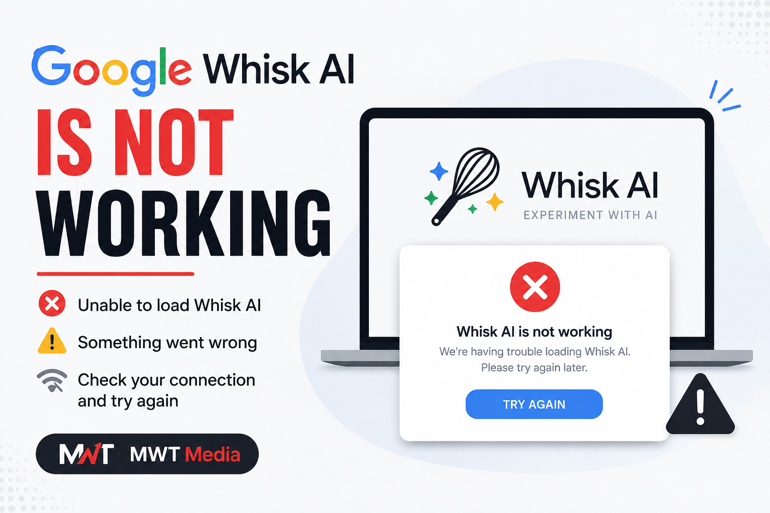
Google Whisk AI is Not Working? Troubleshooting Guide for 2026
If you’ve been searching for why Google Whisk AI is not working, you’re not alone — and the answer in 2026 is very different from what it used to be. This complete troubleshooting guide explains exactly what happened, why Whisk stopped working, and what you should
Read More
Best Minneapolis Agency for ChatGPT and Google AI Overviews Optimization in 2026
The way people search online has fundamentally shifted. Millions of buyers now open ChatGPT, Google AI Overviews, Perplexity, or Bing Copilot and ask direct questions — expecting a direct answer, complete with cited sources. If your business is not inside those answers, you are invisible to
Read More
How to Make Google Gemini Stop Using Nano Banana (2026 Guide)
Google Gemini’s Nano Banana image generation has taken the AI world by storm — but not everyone wants it running every time they fire up a prompt. Whether you are a developer who needs clean text output, a Workspace user who finds image generation distracting, or
Read More
Electrician SEO: The Complete Guide to Rank #1 in 2026
If you’re an electrical contractor wondering why your phone isn’t ringing as much as it should, the answer is almost always the same — your competitors are showing up on Google and you’re not. Electrician SEO is the single most powerful tool you have to change
Read More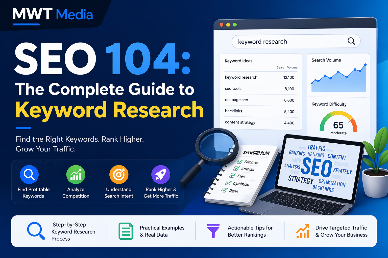
SEO 104: The Complete Guide to Keyword Research
If you have already worked through the fundamentals of search engine optimisation and understand how content, links, and technical structure play their roles, you are ready for the next level. SEO 104 is where strategy gets serious — and keyword research sits at the very heart
Read More
About Aelftech.com: Everything You Need to Know in 2026
In a world where digital presence determines business survival, platforms that offer comprehensive, results-driven solutions are worth paying close attention to. Aelftech.com has emerged as one such platform — a full-service digital technology company offering everything from search engine optimization to cloud infrastructure, eCommerce development, and
Read More
Social Media Ranking Aelftech.com: The Complete 2026 Guide
Introduction In today’s hyper-competitive digital landscape, social media ranking is no longer optional — it is the backbone of every successful online brand. Whether you are a startup, a mid-sized business, or an enterprise, your visibility on social platforms determines how your audience finds, trusts, and
Read More
IT Wordsearch Puzzles: Learn HTML, SQL, DNS and More
Technology education does not have to mean staring at dense documentation. An IT wordsearch is a fun, low-pressure activity that helps you recognize, recall, and remember the technical vocabulary that powers the digital world. In this article, we explore how IT wordsearch puzzles work, which topics they cover,
Read More